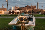
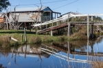
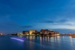
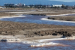
Sea level rise maps show where flooding and inundation is expected. With Castles Made of Sand, I wanted to supplement the generalizations of these maps with specifics. What lies in these low-lying areas and what is at stake? What will be lost? There are many ways to frame these questions.
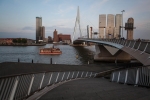
Some of the most advanced thinking and practical implementation of preparation for sea level rise has taken place in the Netherlands. This low-lying country was severely flooded in 1953 and as a result, several thousand people died. While the Dutch had been altering their landscape for centuries and had undertaken the Zuiderzee works in the mid 20th century, the Delta Plan was in direct response to the 1953 storm. Thirteen dams were planned and built to close all the river mouths to the sea including the Oosterscheldekering, which is a storm barrier not a permanently closed dam. The Dutch understanding of living with rising water levels has evolved over centuries. The success of Dutch hydrology is cause for a cautious optimism as sea level rise advances. Make no mistake though: this can’t be done without a tremendous allocation of resources and a strong collective will.
China, in terms of sheer numbers of people, is the country facing the greatest impact from sea level rise. The World Bank released a study in 2013 with lists of the 10 cities most in danger by total cost of damage and by cost as percentage of GDP. Guangzhou was at the top of both lists. And Guangzhou is only one of nine cities in the Pearl River Delta Economic Zone. The others are: Dongguan, Foshan, Huizhou, Jiangmen, Shenzen, Zhaoqing, Zhongshan, Zuihai. This zone has been called “the world’s factory floor.” Rapidly industrialized, primarily since the 1980s, this area represents 10%of the GDP of China. Much of it is built on the alluvial plain created by the silt left by the Xi Jiang (West River), Bei Jiang (North River) and Dong Jiang (East River) as they flow into the Pearl River and the South China Sea. Population estimates for this region vary from 47 million to 66 million as the region is growing very quickly and also has many migrant laborers from other parts of China.
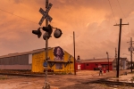
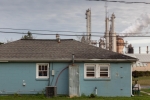
Climate Central and Oxfam frame sea level rise with the question of social vulnerability. The Social Vulnerability Index (SoVI) was conceived of in 2003 and measures 32 factors to determine the level of social vulnerability of a particular community. When social vulnerability is factored in with basic geography and elevation data, two counties in Florida: Miami-Dade and Pinellas on Florida’s Gulf Coast and six in Louisiana: Plaquemines, Vermilion, Iberia, St. Mary, St. James and St. John the Baptist are considered to be the communities most vulnerable to sea level rise in the United States.

